Locating and identifying underground utilities and hazards is key to prevent strikes and mitigate damage. While utility location is primarily handled by locating technicians and utility owners, all parties involved in the HDD process should have a comprehensive understanding of locating best practices and the ability to locate and verify utilities. Damage mitigation is a team game, and that means that identifying potential strike hazards is a shared responsibility.
The locating technician is first in line for locating utilities. In some cases, the locating is handled by different parties. For example, municipal utilities are sometimes located and marked by their own employees. However it’s always wise for the engineer, contractor and drill operator to confirm all locates are accurate.
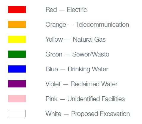
The locate technician’s job begins when 811 is called and a ticket is created. Generally, locates should be completed for that ticket within 2-3 business days. During that time locate technicians and utility owners will visit and review the white-lined jobsite. They will then mark any utilities using the appropriate flag and paint color pictured in Figure 1.
Figure 1. Color codes for utility location
Since locating technicians are the primary locators of a jobsite, this section will discuss best practices from their perspective. Any contractor or engineer that is verifying locates should follow these best practices.
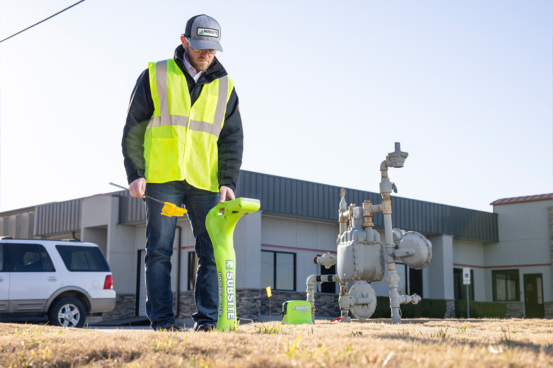
To complete a successful locate, locating technicians will connect their transmitter to a tracer wire attached to a utility or broadcast a signal down a utility and trace and mark the utility to the terminus. Gas and electric lines will almost always have a tracer wire, while water or sewer lines may not. The equipment required generally includes a receiver, transmitter, and cables to create a signal on the utility. It’s also recommended for locate technicians to have clamps to attach around to a utility and place a signal if directly connecting to a tracer wire is not possible for any reason.
The locate technician surveys the jobsite for aboveground utility markers such as gas meters, storm culverts or fire hydrants, as well as potential sources of interference that could affect the accuracy of the locate.
Interference can take an active or passive form. Active interference comes from sources that have their own electrical signal or magnetic field that can distort or interfere with the signal created by the transmitter, altering locating accuracy. Common sources of active interference include dog fences, electrical-based irrigation systems, streetlights, smart gas meters or communication lines that carry a line management signal. Passive interference comes from a source without its own electrical signal, but that can distort the signal placed on the line by the transmitter; for example, storm culverts or chain link fences.
When locate technicians connect the transmitter to a tracer wire, they should perform an ohms reading to determine the signal resistance on the tracer line. Transmitter manufacturers will each have their own recommendations to follow based on ohms readings. Subsite recommends that if the ohms reading is between 500 and 5,000 when using one of its transmitters, a locate technician will have a good chance to perform an accurate locate. If it’s above 5,000, they will need to troubleshoot.
Some manufacturers offer locating equipment than can perform an ambient interference measurement (AIM). If a locating technician has this ability and their survey reveals the possibility of interference, an AIM check will determine which frequencies are present in the environment. Having this knowledge will help the locate technician determine the best frequency to send down the line to increase the chances of avoiding interference present in the environment and producing an accurate locate. Both the frequency and power of a transmitter can be adjusted to improve locate accuracy.
High frequencies are recommended in areas with less opportunity for distortion from passive interference sources. A high frequency like 83k can be sent a further distance down a utility to help trace it, however high frequencies have an increased likelihood of bleeding off onto adjacent utilities or sources of passive interference, causing a mislocate. A higher frequency is often needed, however, in gas lines and cast-iron water lines with rubber gaskets at joints. The high frequency can penetrate the rubber and continue locating.
Lower frequencies are recommended specifically in areas with high passive interference. A lower frequency like 3.14k has a lower likelihood of bleeding off into other utilities or sources of interference, but will need to be amplified by the higher power wattage to travel far enough to create an accurate locate. Some manufacturers offer support by supplying transmitters with up to five power levels to accommodate various situations.
Locating Challenges
One of the most common locating challenges is the high-ticket demands. One-third of surveyed locators by the CGA stated that a heavy workload is the primary challenge they face in providing timely and accurate locates. This is where damage mitigation needs to be a group effort. White-lining is one way in which project engineers and contractors can aid locators. Another strategy that some states are taking is changing utility registration from Quarter-Section Registration to Buffered Centerline Registration. This determines how utility owner registers need to respond to an 811 ticket. In the past, utilities were registered by section in a state, county or territory depending on the area population and locates would be needed in that section if 811 was called. Even if there were no utilities in that section, utility owners would still need to go mark that no utilities were found. Buffered Centerline Registration is focused on where the centerline of a utility is known to be. If a request is submitted but the centerline of the utility is not within the state regulated distance from an 811 call, the utilities won’t require marking. Oklahoma is one state that uses Centered Buffered Registration.
Figure 2 demonstrates how Oklahoma’s locate demand became more manageable after shifting to Buffered Centerline Registration.
Before – Quarter-Section Registration After – Buffered Centerline Registration
Figure 2. The locate notices decreased by 7.92% for in line locating after changing to Buffered Centerline Registration in Oklahoma. These graphs are provided by Okie811.
Buffered Centerline Registration reduces the workload of locators without reducing the efficacy of the damage mitigation process, which in turn makes damage mitigation a more attainable goal for all involved. However, the move to Buffered Centerline Registration highlights the importance of gathering GPS data on utilities and pre-drill surveys.
From high-ticket demands to high-noise environments, the challenges of proper utility location can be hard to overcome. However, with GPS, data collection, and other technology advancements, the shared responsibility of proper utility location and damage mitigation should be just a little bit easier.
This is the second article of the three-part series on fiber. See below to read the other two articles.


